SEARCH
Contact

Local History

Our Traditional Custodians

The Wadjuk Noongar people are the Traditional Custodians of the City of Bayswater. 

The Wadjuk Noongar people have lived in the Bayswater area for thousands of years, the remains of a campsite have been found at nearby Upper Swan which is believed to be between 40,000 and 53,000 years old, making it one of the oldest lands on earth.

The Noongar people were nomadic hunter-gatherers, moving frequently as they followed the seasons and food sources, at the time of European settlement, it is believed the Noongar people spoke 13 dialects. The Swan River holds special significance to the Noongar people as they believe that a Wagyl - a snakelike being from the Dreamtime, meandered over the land creating the rivers. 

Noongar can also be spelt Nyungar, Nyoongar, Nyoongah, Nyungah, Nyugah and Yunga. The Noongar people occupied the entire South West region of Western Australia, from Geraldton to Esperance. Noongar country refers to 14 different groups that occupied seven territories: 

Territory in Western AustraliaNoongar Group
Geraldton SandplainsAmangu and Yued
Swan Coastal PlainYued, Wadjuk, Binjareb and Wardandi
Avon Wheatbelt Balardong, Nyakinyaki, Wilman
Jarrah ForestWhadjuk, Binjareb, Balardong, Wilman, Kaneang
WarrenBibulmun, Mineng
MalleeWilman, Koreng and Wudjari
Esperance Plains Njunga

Local History

1697 - 1800's

The first European exploration of the Swan River took place in 1697 by Dutch explorer Willem de Vlamingh. This was followed by the French during the next century and the English in 1827. The English, encouraged by James Stirling's report on the area's fertility, decided to establish the Swan River Colony. The land along the Swan River was divided into a number of narrow strips of land, which would later shape the pattern of suburban development.

Most of the land in Bayswater was either of very poor quality, waterlogged, or both. After a short period of occupation, land in the Bayswater area was abandoned as the English settlers moved on to more productive areas. In the meantime, the traditional Aboriginal hunting and gathering patterns began to deteriorate as the rule of the settlers became harsher and they were forced to turn to rations for food.

1800's - 1900's

Until the 1870s, a period of “absenteeism” occurred. The owners of the Bayswater land were often living in the eastern colonies, or even overseas. The only obvious evidence of colonisation in the district for much of this time was a track that ran through the area between Perth and Guildford. This track would later become known as Guildford Road.

In 1881, the Perth-to-Guildford railway line was built, passing through Bayswater. As with many areas along the railway line at this time, Bayswater underwent enormous changes. A minor property boom occurred and subdivision of the original land grants began. The first property to be developed between Drake and Lawrence Streets was called the Bayswater Estate. Land speculation intensified when gold was discovered in the eastern parts of the colony. The gold rushes attracted thousands of people from the eastern colonies and from overseas and many of these eventually settled in the Bayswater area.

In 1887, the Perth Road Board decided to construct a track between North Perth and what is now Bassendean. This later became known as Walter Road and it later became the focus of the small, semi-rural communities of Morley Park and Hampton Park. The district was still sparsely settled at this time. Land was still relatively cheap and many people bought a number of adjacent blocks in order to have land to farm. Although there were still few residents in the area, those present managed to pressure the Board of Education into building a small school by 1894.

The provision of basic services often lagged well behind demand. As new residents continued to arrive, pressure on existing resources became acute. Many of the local residents felt they were not properly represented by either the Swan or Perth Road Boards, between which the area was split. Pressure for local representation came to fruition in 1897 with the gazettal of the Bayswater Road Board.

1900 - 1930

World War I had a huge impact on Bayswater with many men going to Europe to fight.   Although the war was on the opposite side of the world, it was the centre of life for the people of Bayswater. Military convoys along Guildford Road and shelling practice on the river flats were constant reminders of the war.

The 1920s brought new development to Bayswater with many houses being built in the new suburb of Bedford, following the extension of Beaufort Street as far as Coode Street. At the other end of the district, factories were beginning to dominate what would become the industrial area, with the Cresco factory built in 1928. Occasionally, Aboriginal camps would still be set up on the outskirts of the Bayswater townsite during the 1920s and one “old men's camp” existed on Guildford Road for years. 


1930 - 1940

The Great Depression of the 1930s was devastating to Bayswater as much as anywhere else. The council began receiving applications for families to live in tents in 1931 and many lived in squalid conditions for years at a time. One tent settlement was at the northern end of Beechboro Road, inhabited by disillusioned group settlers. The Garratt Road Bridge was opened in 1935, the result of “sustenance labour”. In 1933, Bayswater introduced its first primitive Town Planning Scheme, about 30 years ahead of most other local governments. This scheme reinforced the location of the already-developing industrial area in the east of the district and set aside land for future residential growth.

1940 - 1970

Although unemployment fell after about 1934, the Depression did not really end until the outbreak of the World War II. Once again, many Bayswater residents went overseas to fight the enemy. Bayswater became centre of signalling operations and many homes were taken over for use by the army or used as billets for the signalmen. For Bayswater residents, World War II differed from World War I because the threat was immediate and air raid drills were practised regularly. For months, a Japanese invasion was expected imminently.

The end of World War II signalled the start of a dramatic period of growth in the district, as returning soldiers and then immigrants flooded into the country. The Bayswater Road Board district was well-placed for the suburban expansion of Perth, located so close to the city centre. Between 1947 and 1954 the population more than doubled to 14,555. Areas such as Hampton Park (now part of Morley) were dotted with half-built houses, many of which were occupied even though only one or two rooms had been completed. As many people worked full-time, as well as building their own houses, the sounds of construction could be heard well into the night.

Such rapid growth was typical of many areas in the district and basic facilities such as schools were not built until well after they were needed. Buildings from East Fremantle Primary School were transported to the Hillcrest site in a desperate bid to provide education to the hundreds of children living in the rapidly-growing Bedford.

During the late 1950s, Morley began to develop as a major shopping and commercial area. The opening of the Wirrina drive-in in 1958 was followed by Boans in 1961 and many other businesses followed. This growth was fuelled by a large new area of state housing in the newly formed suburb of Embleton. During the 1960s, the shire developed more rapidly than ever before. It was in this decade the Bayswater Library, Senior Citizens Centre and the golf course were all built.


1970 - 2000

During the post-war years, the responsibilities of the council increased enormously. Where once the construction of roads was the “bread and butter” of local government, the Shire of Bayswater was now expected to plan the growth of the shire, develop new areas and provide landscaped parks, recreation and aged care facilities and a host of other services. This was typified by the construction of the Bayswater Aquatic Centre and Mertome Retirement Village in the 1970s.

The development of the suburb of Noranda also occurred during the 1970s by the Shire. This was achieved through a resumptive scheme, where the shire acted as developer on behalf of a number of land owners. Noranda was carefully planned for years before the land was finally released for sale. This project was later followed by another resumptive scheme: the Carramar Estate.

In the early 1980s, the Tonkin Highway was built.  Unfortunately, the highway cut through the old communities of Whatley and Hampton Park, changing the character of these areas forever. The construction also had the effect of cutting off the old routes of Walter Road and Beechboro Road. An overpass was instead built at the newer Broun Avenue.

In 1983, the Shire became the City of Bayswater, a reflection of its increased population and changed character. This coincided with the move to the current council offices at 61 Broun Avenue, Morley.

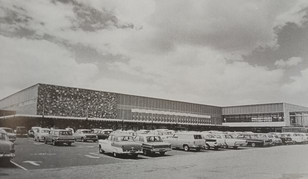
The Galleria shopping centre opened in 1994, on the site of the old Boans building that burned down in 1986. Morley is one of the largest commercial district outside Perth and further growth is expected.


2000 - Present

The City's population is growing with significant infill development occurring throughout all of the suburbs.  Development is focused around the train stations of Maylands and Bayswater and the Morley activity centre.  These areas are experiencing significant increases in residential densities and new retail developments. 

Go to Top of the page